


Itineraries
Looking to explore Australia's Coral Coast but don't know where to start?
Our suggested itineraries are the perfect guide to help plan your next Coral Coast adventure. Whether you choose to fly, drive or a combination of both, each of our carefully curated itineraries suit a range of schedules so all you have to worry about is what to pack.
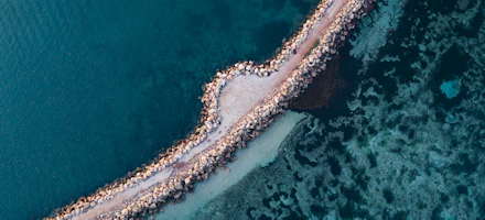
The Ultimate Road Trip

The Coral Coast Highway
The 1,250km (800 miles) Coral Coast Highway from Perth to Exmouth is one of Australia's Great Scenic Drives, and has been referred to as one of the…

Ultimate Self-Drive Road Trip
The Coral Coast Highway Road Trip: a Perth to Ningaloo round trip self drive holiday.

Family Self Drive
Australia's Coral Coast has a seemingly endless variety of family-centric activities on offer, many of which are not available anywhere else in the…

The Ultimate Bucket List Itinerary
The Coral Coast is full of bucket-list experiences from swimming with whale sharks to visiting the iconic Pinnacles Desert.
@CJMaddock Trail Maps

Exmouth & Coral Bay Instagram Trail Map
Get your trail on and add these top nine insta-worthy spots to your must-visit list when visiting Exmouth and Coral Bay. This itinerary has been…

Carnarvon Instagram Trail Map
The top 9 spots to stop for a photo in Carnarvon. This itinerary has been created in partnership with Charlotte & James Maddock (@CJMaddock).

Shark Bay Instagram Trail Map
Want to know the best spots in Shark Bay for those insta-worthy snaps? We have you covered. This itinerary was developed in partnership with…

Kalbarri Instagram Trail Map
Kalbarri is a picture-perfect place just waiting for you to discover. Follow along our Kalbarri Instagram trail map for the best locations to capture…

Geraldton Instagram Trail Map
Use this handy map and custom photography tops from @CJmaddock and start planning your take on the #GeraldtonTrail. This itinerary was developed in…

Turquoise Coast Instagram Trail Map
Located along Indian Ocean Drive, Turquoise Coast has an abundant of insta-worthy locations so you can capture the perfect photo. This itinerary was…
Indian Ocean Drive Itineraries

Indian Ocean Drive Getaways
Short on time? Get inspired with our one and two-night suggested itineraries for a quick break along the Indian Ocean Drive.

4 day Indian Ocean Drive getaway
Starting from Cervantes spanning north, the Indian Ocean Drive (road extension off Perth's Yanchep suburb) offers a scenic journey to the coastal…
Turquoise Coast Instagram Trail Map
Located along Indian Ocean Drive, Turquoise Coast has an abundant of insta-worthy locations so you can capture the perfect photo. This itinerary was…
Discover Geraldton

Geraldton Food & Beverage Trail
Nine food and beverage spots to add to your Geraldton itinerary. From freshly caught Abrolhos seafood to Middle Eastern flavours with a twist and…

5 day Geraldton Adventure
Depending on the time of the year, Geraldton can be a destination in itself or a perfect hub to enjoy many regional experiences and attractions. …

Geraldton Coastal City Fly Itinerary
The largest city on the Coral Coast, Geraldton has established itself as a contemporary coastal hub of cafés, shops, street art and galleries. The…
Geraldton Instagram Trail Map
Use this handy map and custom photography tops from @CJmaddock and start planning your take on the #GeraldtonTrail. This itinerary was developed in…
Explore Kalbarri

Kalbarri Food & Beverage Trail
Kalbarri's culinary scene is a delightful mosaic of diverse flavours and experiences. From charming coffee vans to lively breweries, cafes and…
Kalbarri Instagram Trail Map
Kalbarri is a picture-perfect place just waiting for you to discover. Follow along our Kalbarri Instagram trail map for the best locations to capture…

3 day Perth to Kalbarri road trip
The Kalbarri region is a favourite family holiday destination also known for its adventure experiences on the water and land-based attractions.

Everlastings Trail
Base yourself in Geraldton to explore north to Kalbarri National Park, and east to experience the excitement of finding the unique Wreath Flowers…
Shark Bay Itineraries

Shark Bay Fly-Away
When you throw in a flight, a three-day break on Australia’s Coral Coast can feel like you’re miles away in ancient lands. Regular flights to Monkey…

Monkey Mia Getaway
This fly-stay itinerary gives you the opportunity to meet the famous Monkey Mia dolphins and discover the breathtaking natural beauty of the Shark…

Dirk Hartog Island Adventure
If you're looking for an off-the-beaten-track adventure, look no further than Dirk Hartog Island in the UNESCO Shark Bay World Heritage Area.

6 day Perth to Shark Bay Road Trip
Head north to Denham and Monkey Mia on Australia’s Coral Coast and discover a World Heritage listed region renowned for its unique natural wonders…
Shark Bay Instagram Trail Map
Want to know the best spots in Shark Bay for those insta-worthy snaps? We have you covered. This itinerary was developed in partnership with…
Discover Ningaloo

Swim with Whale Sharks in a Weekend
Your dream encounter is closer than you think! Ningaloo is the only place in Western Australia where you can swim with whale sharks and here’s how…

Ningaloo Reef Discoverer
This fly-stay itinerary gives you the opportunity to discover the spectacular Ningaloo Reef region of Western Australia’s Coral Coast.

8 day Ningaloo Self-Drive Itinerary
Right on the doorstep of Exmouth, Ningaloo coral reefs invite you to dive right in. Water lovers of any age will delight in the opportunities to…

World Heritage Areas Fly & Drive Itinerary
Discover Western Australia’s magnificent Ningaloo and Shark Bay World Heritage Areas on this fly/drive itinerary.

5 day Coral Bay Adventure
Coral Bay is a marine paradise and one of Western Australia’s premier family holiday destinations. Named Coral Bay due to the beautiful coral gardens…

Carnarvon's Outback Coast
Discover Western Australia's beautiful southern gateway to the Ningaloo World Heritage Area, Carnarvon.

Ningaloo Food & Beverage Trail Map
The culinary scene along Ningaloo's coastline mirrors the natural beauty of the region from Carnarvon to Exmouth. Whether it's fine dining, bars,…
Wildflower Itineraries
Everlastings Trail
Base yourself in Geraldton to explore north to Kalbarri National Park, and east to experience the excitement of finding the unique Wreath Flowers…

2 day Wildflower Itinerary
Explore the coastal and inland towns of Cervantes, Jurien Bay, Badgingarra and Eneabba as you spend your weekend wildflower hunting. This itinerary…

11 day Ultimate Wildflower Trail
Explore the region from top to bottom in search of unique species and carpets of everlastings during late July to early October.

Wildflowers, Wild Stars 5 day itinerary
Take a road trip to the stars and dark skies of Western Australia's Coral Coast.

4 day Wildflower itinerary
Take a long weekend to enjoy the Coral Coast's wildflower season and explore the regional towns of Wildflower Country and the city of Geraldton.

Gascoyne Wildflower Trail
The Gascoyne region is home to some incredible and unique wildflowers which bloom during late winter and spring. This itinerary can be done in 3 - 5…

6 day Wildflower itinerary
Pull on those hikers for a week of wildflower hunting along the Indian Ocean Drive through to Kalbarri and back to Geraldton and onto Wildflower…

Cape Range Wildflower Trail
Exmouth's Cape Range National Park is home to an abundance of incredible and rare flora. The Cape Range National Park is a spectacular national park…
Mid West-Gascoyne Wildflower Trail
Take a journey along the north-west trail to experience a sensational show of wildflowers that cling to the vast landscape, adding brilliantly vivid…


